


| Colorado Springs Local NWS Severe Weather Alerts |

|

|

|
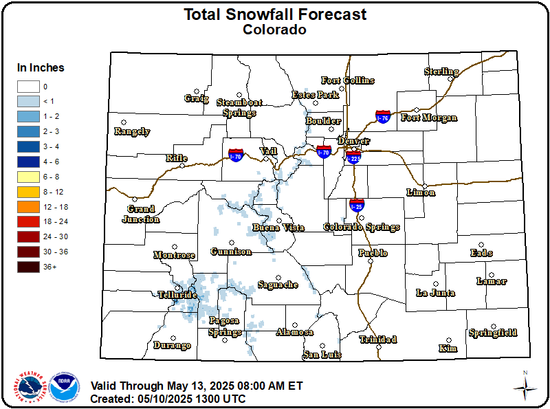
| NWS Local Radar Loop | NWS Alert Map | National Radar |
| Live Data Updated: 26-Jul-2024 9:55pm - next update at 12:15am | |||||||||||||||||||||||||||||||||||||||||
| Summary / Temperature | Wind | Rain | Outlook | ||||||||||||||||||||||||||||||||||||||
|
|
|
|
||||||||||||||||||||||||||||||||||||||
| Humidity/Barometer | Almanac | Moon | |||||||||||||||||||||||||||||||||||||||
|
|
|
|||||||||||||||||||||||||||||||||||||||
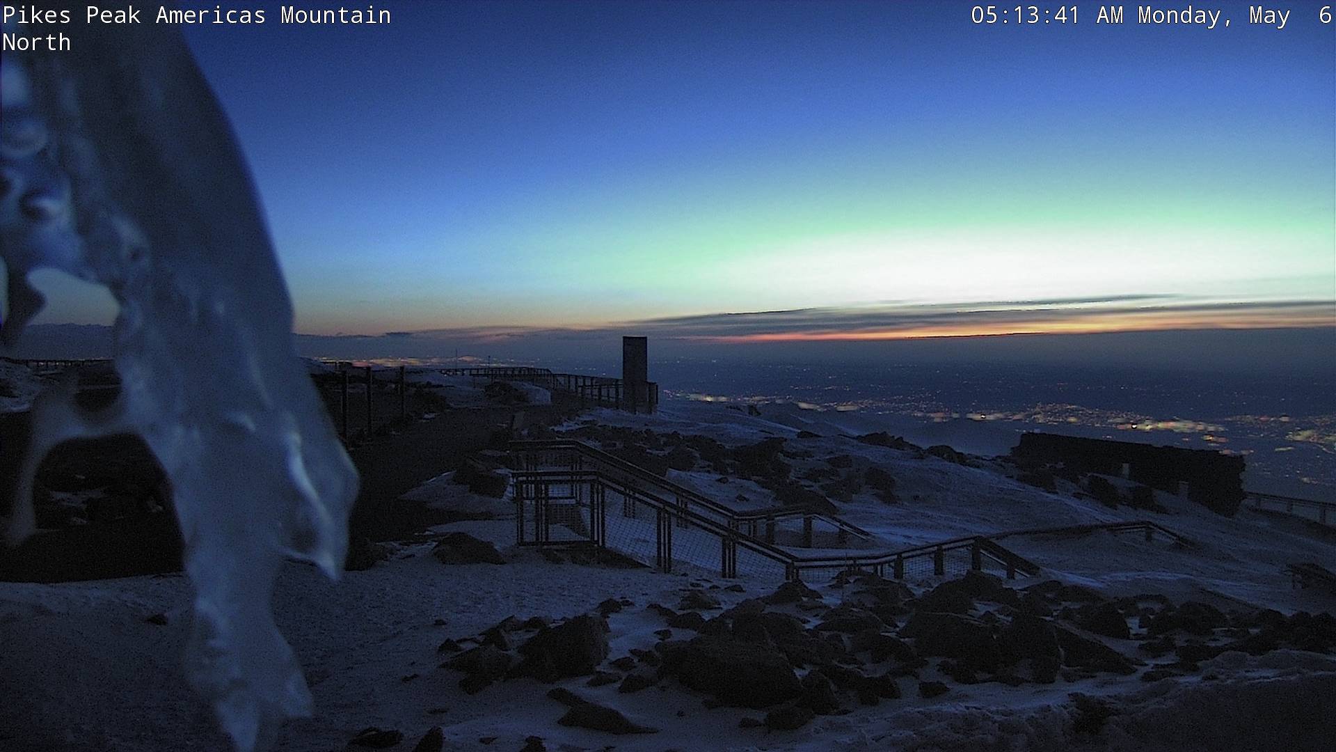
| Fire Danger | Pikes Peak Summit Webcam | ||||||||||||||||||||||||||||||||||||||||
|
|
|
||||||||||||||||||||||||||||||||||||||||

| NWS Weather Forecast - Outlook: Tonight & Saturday | ||||||
|
||||||
| NWS Extended Weather Forecast for Colorado Springs |
|
Saturday Night Chance Showers And T-Storms then Partly Cloudy |
Sunday Sunny |
Sunday Night  Mostly Clear |
Monday Sunny |
Monday Night Mostly Clear |
Tuesday Sunny |
Tuesday Night Mostly Clear |
| Lo 57 °F | Hi 90 °F | Lo 58 °F | Hi 91 °F | Lo 60 °F | Hi 93 °F | Lo 62 °F |